

PAMELi’s missions ara as varied as the sensors installed onboard…
The Cyclopée system installed on PAMELi plateform allow to measure sea surface height along a profile in order to create a “sea surface height map“.
Advantages of PAMELi :
- Follow satellite tracks
- Stabilized and repeatable measurements
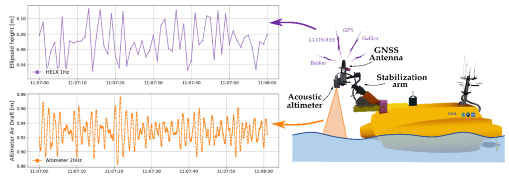
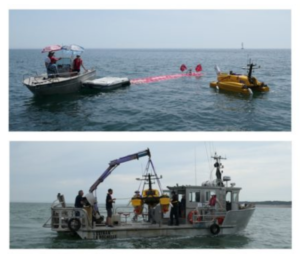
In June 2019, a PAMELi campaing along Jason 3 satellite track, in the Pertuis Charentais area, allowed to compare the Cyclopée system with the CalNaGeo towed carpet (the red carpet on the photo →). The results showed that :
- For a fixed position, these two systems are now comparable in terms of precision with the best available tide gauge systems.
- Along a profile, in motion, the two systems provide maps of SSH variations that are consistent on a centimetric level.
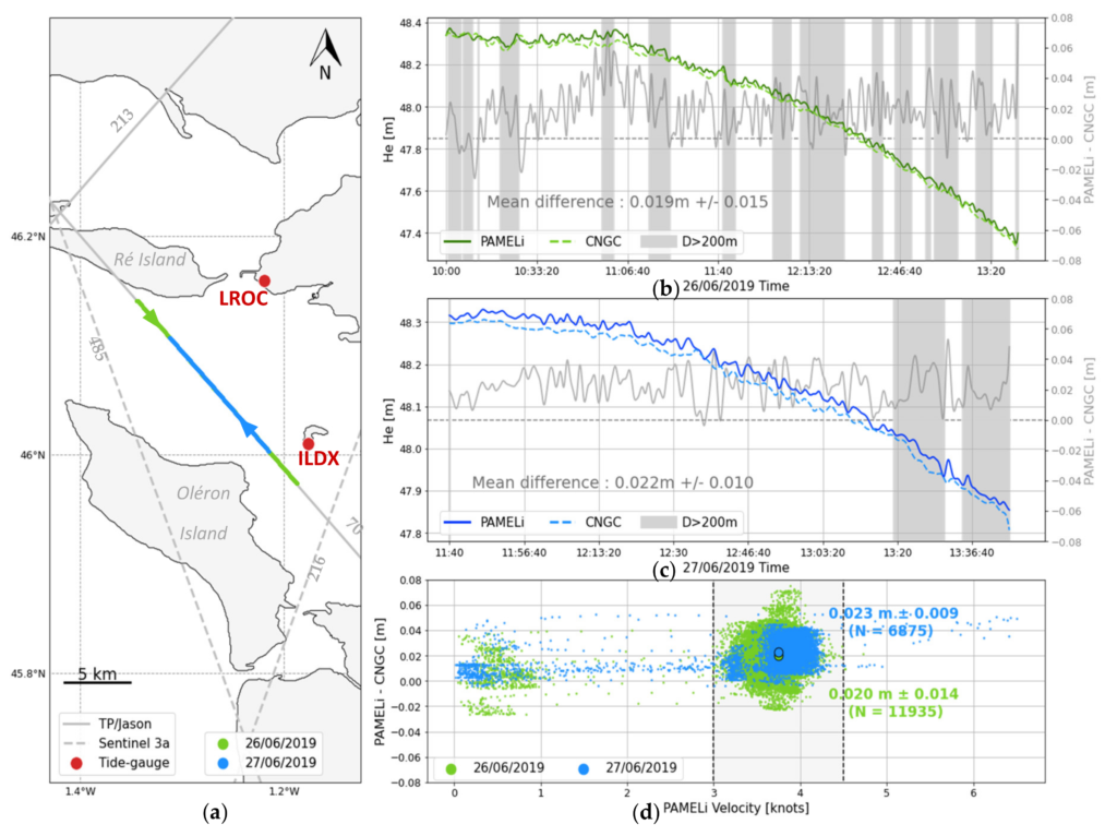
A high resolution hydrodynamic model in the Pertuis Charentais area is developped to remove the temporal component (tide,…) of the PAMELi observations. We will access to the local mean sea surface which is close to the geoid. We can then direcly compare with Jason 3 altimetric observations to estimate the quality of its measurements in coastal area.
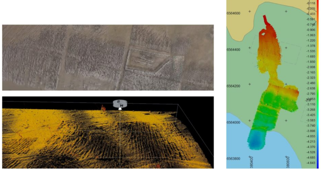
A bathymetric campaign was organised in Angoulins bay to identify boulders in the marine culture area.
Advantages of PAMELi :
- The Norbit iWBMS mutlibeam (200KHz – 700KHz) on PAMELi allows high resolution seabed mapping.
- Optimal for area with difficult access (shallow seabed, water reservoirs, etc.)
During field campaing, PAMELi can repeat a programmed route, follow a track and maintain a position. In these coastal environnements, spatialized measurements of water parameters are carried out. This will help to understand the physical processed involved in the area.
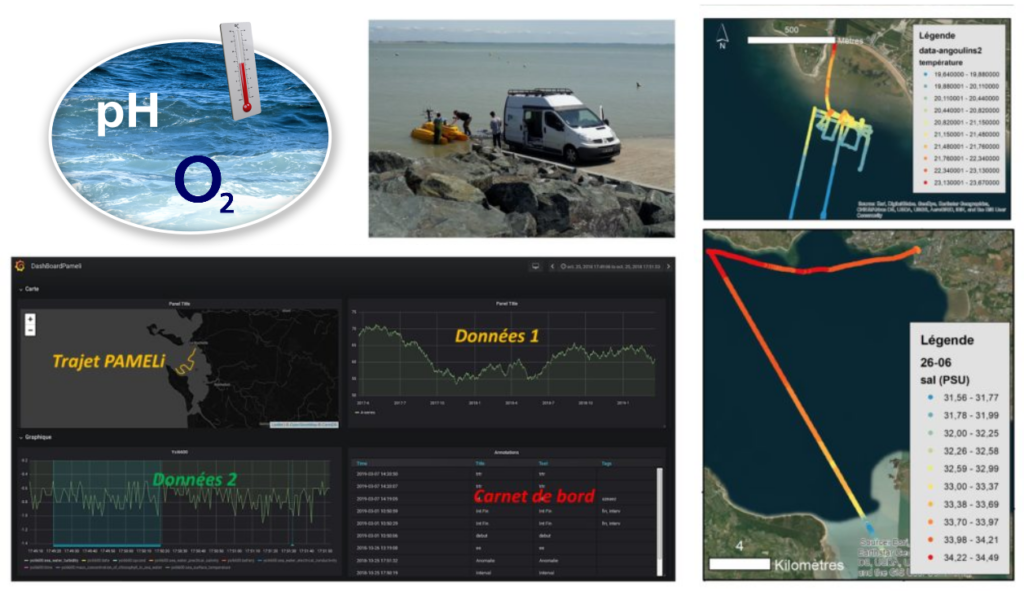
Advantages of PAMELi :
- Continuous measurements.
-
- Real-time acquisitions reading.
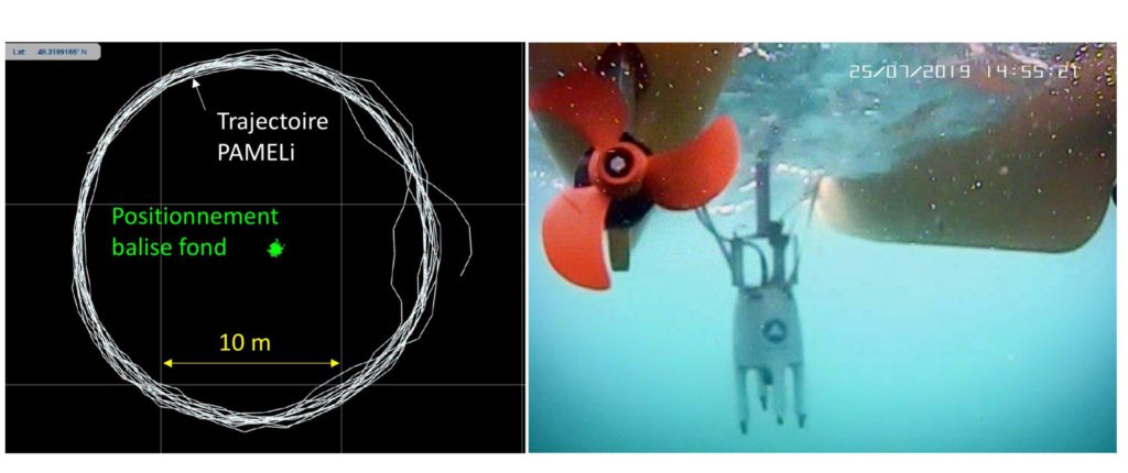
The GNSS/A (for Global Navigation Satellite System / Acoustic) is a precise underwater positioning methodology, which is currently developed in Earth Sciences. The objective is to quantify seabed movements, mainly due to plate tectonics. Indeed, these displacements provide information on stress accumulation in fault zones and are therefore one of the fundamental elements in seismic and tsunami evaluation in the marine domain. GNSS positioning (GPS is the most well-known GNSS system) is based on electromagnetic waves that do not propagate underwater. In the case of GNSS/A, a surface platform (here the PAMELi drone) is the relay between aerial positioning (GNSS) and underwater positioning (acoustic).
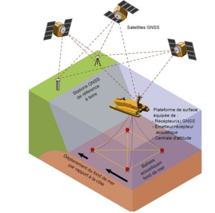
LIENSs laboratory and IUEM work together to develop underwater measurement methodology, in particular GNSS/A which does not currently exist in France. After initial experiments using an oceanographic vessel, we conducted the first GNSS/A campaign with PAMELi in the Brest bay in July 2019. For this project, we are also collaborating with iXBlue company which lent us the GAPS system combining an inertial navigation unit and acoustic distance measurement to acoustic beacons installed on the seafloor. PAMELi was therefore used as surface support for the GAPS to identify and position the CANOPUS beacons.
Advantages of PAMELi :
- Limit noise level.
- PAMELi “Orbit” mode to repeat a defined route.
- Simplified deployment and manoeuvring of the instrument.